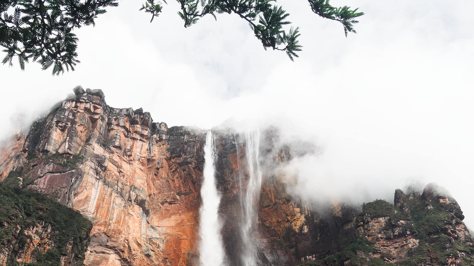

Canaima, Venezuela
Angel Falls Venezuela: How to Visit the Waterfall from Canaima Camp
979 metres off the flank of Auyán-tepui, most of it turning to mist on the way down. The approach is by river, and the river only carries boats in the wet season, so the season is the first decision.
- Total drop
- ≈979 m
- Single plunge
- ≈807 m
- Season
- Jun–Nov
Where is Angel Falls, in practical terms: at the end of a flight and a river. It drops off the flank of Auyán-tepui in Canaima National Park in south-eastern Venezuela, about 979 m in total, with a single uninterrupted plunge of roughly 807 m that makes it the highest waterfall in the world. No road reaches it. Understanding how to visit Angel Falls Venezuela is mostly understanding that constraint.
Asking where is Angel Falls on a map and asking how to reach it produce very different answers, and only the second one matters when you are planning.
The water falls so far that much of it is mist before it lands, which is what the photographs show and what almost every description of the place mentions. In Pemón it is Kerepakupai Merú; the English name comes from Jimmie Angel, the aviator who put his plane down on top of the tepui in 1937 and left it there.
How to visit Angel Falls Venezuela: the flight, the river and the walk
Every trip starts at Canaima camp, which has an airstrip, a lagoon with its own set of waterfalls, and no road out. Flights come in from Ciudad Bolívar and Puerto Ordaz, and the camp is where the river stage is arranged.
From there it is four to six hours upstream by curiara, a long motorised dugout run by Pemón crews, along the Carrao and then the Churún, through rapids, with everybody aboard soaked by lunchtime. The boats stop at a river camp, usually Isla Ratón, where you sleep in a hammock under an open roof.
The next morning is a walk of about an hour through forest to Mirador Laime, the viewpoint facing the falls, with a pool below it that groups swim in. Working out how to visit is really working out that sequence: the flight is fixed, the river is the variable, and the viewpoint is one morning at the end of it. Then the same river back. Three days is the standard shape of the trip and two days is the compressed version, which buys you nothing except a shorter absence.
Why the season decides everything at this waterfall
The single most useful of the angel falls facts is this one: the river is the road, and the river only works part of the year. Between roughly June and November the water is high enough for the curiaras and the falls run at full volume. Between December and May the rivers drop, the boats often cannot get up, and the falls themselves can thin dramatically.
That gives the trip an unusual trade-off. The months with the water are also the months with the cloud, so the same rain that lets you reach the viewpoint may hide the top of Auyán-tepui when you get there. Nobody sells a guaranteed view, and any operator who does is selling weather they do not control.
Two more angel falls facts belong with that one: the falls are at their loudest in the weeks just after the heaviest rain, and the viewpoint is downstream of the plunge, so the mist reaches you before the noise does.
In the dry months, overflights from Canaima are the alternative: an hour in a light aircraft, no river, and the falls seen from the air rather than from below.
Canaima National Park and the tepui it comes off
Canaima National Park covers about 30,000 km² of south-eastern Venezuela and was inscribed as a UNESCO World Heritage site in 1994. Roughly two-thirds of it is tepui, the flat-topped sandstone massifs that give this part of the continent its shape. Auyán-tepui, the one the falls come off, is among the largest of them.
That is the reason for the volume and the reason for the height. Rain falls on a plateau of bare sandstone that holds almost nothing, gathers into channels, and goes over the edge of a wall several hundred metres high. Every tepui in Canaima National Park does some version of this; Angel Falls Venezuela does it further than anywhere else on earth.
No angel falls map will show you a road in, because there is none to draw. What it does show usefully is the relationship between Canaima camp, the two rivers and the tepui. Read an angel falls map as a sequence rather than as a location, and the trip explains itself.
Where it sits in a Venezuela trip
Most people who come this far also walk Mount Roraima, further south in the same tepui country and reached from Santa Elena de Uairén rather than from Canaima. The two are the standard pairing and they have opposite logistics: Roraima is six days on foot in the drier months, Angel Falls is three days on water in the wetter ones, which is worth knowing before you try to fit both into one fortnight.
Angel Falls Venezuela is, in the end, a three-day commitment for one morning of looking at something, and everyone who has done it says the river was half of it.
The rest of the region is covered in the Venezuela section. As with any trip in this part of the country, the practical conditions (flights, fuel, permits, cash) are the part that needs current information rather than a page like this one.
Frequently Asked Questions
Where is Angel Falls?
In south-eastern Venezuela, in Bolívar state, inside Canaima National Park. It falls off the flank of Auyán-tepui, and the nearest settlement is Canaima camp on the Carrao river, which has an airstrip and no road connection to the rest of the country.
How high is it?
About 979 m in total, of which roughly 807 m is a single uninterrupted plunge. Both figures come from Ruth Robertson's 1949 survey and have never been independently re-measured, and whether the single plunge or South Africa's Tugela Falls is the taller is unresolved. Below that the water hits a slope and continues as cascades to the base.
How do you get there?
Fly to Canaima camp, then take a motorised curiara up the Carrao and Churún rivers for four to six hours, camp overnight in hammocks at Isla Ratón, and walk about an hour through forest to the Mirador Laime viewpoint the following morning.
Can you drive to Angel Falls?
No. There is no road to Canaima camp and no road anywhere near the falls. Every visit begins with a flight, and the last stage is on water and on foot.
When is the best time to visit?
June to December, the wet season, when the rivers are high enough for the boats and the falls are at full flow. The trade-off is cloud: the top of the tepui is often hidden, and a clear view is partly luck.
Can you go in the dry season?
You can go to Canaima, but usually not up the river: the water is too low for the curiaras between roughly December and May, and the falls themselves can thin to a ribbon. Overflights operate year-round and are the dry-season substitute.
How long is the trip?
Three days is the usual package from Canaima: river up, overnight camp, viewpoint, river back. Two-day versions exist and mean a lot of boat for one look at the falls.
What are the boats like?
Open dugout-style curiaras with outboard motors, run by Pemón crews who know the rapids. You will get wet, everything not in a dry bag will get wet, and there is no shade.
Where do you sleep?
In hammocks under an open shelter at a river camp, with mosquito nets. This is not optional or upgradeable, because there is no lodge at the falls.
Can you swim at the base?
There is a pool below the falls that groups swim in after the walk from the camp. It is cold and the current near the cascades is strong, so people stay where guides put them.
Who was it named after?
Jimmie Angel, an American aviator who flew over the falls in the 1930s and landed on top of Auyán-tepui in 1937, where his plane bogged down and stayed. In Pemón the falls are Kerepakupai Merú.
Is it safe to travel there right now?
The falls are remote and the trip itself is run by experienced local operators, but conditions in Venezuela (flights, fuel, cash, permits) have changed repeatedly over the last decade. Check current government travel advice and talk to operators actually running trips this season before booking anything.