Travelling in Guatemala: the Highlands, the Volcanoes and the Karst
The densest part of this site: a country the size of Tennessee holding three volcanic ranges, twenty-two Mayan languages and the best-preserved colonial town in Central America.
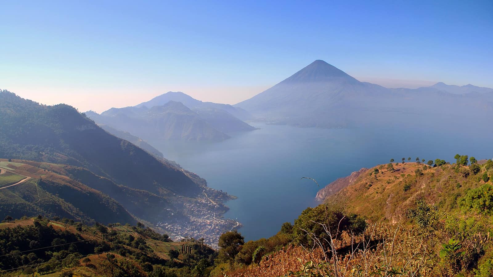

Guatemala travel works in a small compass. Antigua to Lake Atitlán is three hours; Atitlán to Chichicastenango is ninety minutes; the whole western highland circuit fits inside a fortnight without a single internal flight. What takes the time is not distance but road surface and market days.
The country divides, for a visitor, into four parts: the colonial valley around Antigua, the highland lake and its weaving towns, the Quiché market towns north of it, and the karst country of the Verapaces further east. The Petén lowlands and Tikal sit apart from all four and are usually flown to.
- Acatenango Chimaltenango, Guatemala
An overnight climb to nearly 4,000 m above Antigua, camped on a ridge facing Volcán de Fuego, which erupts through the night in full view.
- Antigua Guatemala Sacatepéquez, Guatemala
Colonial capital from 1543 until the 1773 earthquakes moved the government away, and the abandonment is exactly why the townscape survives: ruined convents left standing where a working capital would have cleared them.
- Chichicastenango market Quiché, Guatemala
Twice a week the K'iche' town fills its plaza and the steps of Santo Tomás, and most of what changes hands is still for the towns around it rather than for visitors.
- Lake Atitlán Sololá, Guatemala
A flooded caldera ringed by three volcanoes, with a dozen towns around the shore that differ in dress, dialect and trade. The launches, not the roads, are the real network.
- Mayan ruins Petén, Izabal and the wider Maya area
Sites are not interchangeable: one is the tallest, one is the most finely carved, one is empty of visitors, and choosing badly wastes a day and a long drive.
- Pacaya volcano Escuintla, Guatemala
The accessible volcano: a half-day round trip from Antigua onto ground that was liquid within living memory, and the one climb in Guatemala that does not require a night on a mountain.
- Semuc Champey Alta Verapaz, Guatemala
A 300-metre limestone bridge carrying a staircase of pools, with the Cahabón running underneath it through the rock. The K'anba caves are the same karst and the same day.
- Traje: Highland Maya dress Western Highlands, Guatemala
Traditional dress is still worn daily in the Guatemalan highlands, and it is village-specific: the huipil of Nebaj is not the huipil of Todos Santos. Twenty-two Mayan languages, dozens of towns, and a cloth that says which one before anyone speaks.
The volcano line
Three volcanoes stand over Antigua, Agua, Fuego and Acatenango, and two of them are climbed. Pacaya, closer to the capital, is the half-day option and the one where you walk on recent lava. Acatenango is an overnight, cold and high, and the reason people come back with photographs of Fuego erupting below the camp.
Fuego's activity varies, and access to the ridge opposite it closes when it escalates. That is a decision the national authority makes at short notice, not something to plan around months ahead.
Which volcanoes are actually active
Guatemala has a long volcanic chain and a short list of volcanoes that behave like active ones. INSIVUMEH, the national institute for seismology, volcanology, meteorology and hydrology, publishes a daily volcanological bulletin, and it covers three: Fuego above Antigua, Pacaya south of the capital, and Santiaguito above Quetzaltenango in the west. Everything else on the chain is quiet on any timescale a visitor needs to plan around.
That three-name list is the practical filter for a highland trip. The volcanoes with something to see are the same three whose access can close at short notice, which is why the bulletin is the thing to read rather than a tour page. Santiaguito is the one this site does not cover as a climb: it is a growing dome complex rather than a walk-up, the standing recommendation is to stay several kilometres back from the domes, and it is watched from a distance rather than ascended.
Market days, and why they run the itinerary
Chichicastenango is Thursday and Sunday. Sololá, above Lake Atitlán, is Friday. Antigua's market runs daily and is the least interesting of the three because it never has to be anybody's only chance to trade.
Building a highland week around those fixed days rather than around hotels is the single change that most improves a first trip here.
The Verapaz karst
East and north of the highlands the limestone takes over: Semuc Champey's pools, the K'anba caves under them, the Lanquín bat cave, and a whole system of river caves that were the subject of serious exploration through the 1990s and 2000s. Getting there is the cost: the roads are unpaved and the journey from Antigua takes most of a day.
When to go
November to April is dry and reliable. May to October brings afternoon rain that is usually predictable enough to plan mornings around, greener hillsides, and worse unpaved roads. Semana Santa in Antigua is the country's largest event and the worst week to arrive without a booking.
Frequently Asked Questions
How long do you need in Guatemala?
Two weeks covers the western highland circuit (Antigua, Lake Atitlán, Chichicastenango and a volcano) without moving every day. Adding the Verapaz karst or Tikal pushes it to three.
What is the best time of year?
November to April is dry and reliable. May to October brings predictable afternoon rain, greener country and worse unpaved roads. Semana Santa is the one week to book far ahead or avoid.
Is it safe to travel around Guatemala?
The tourist circuit is well established and the towns on it are used to visitors. Standard precautions cover it: tourist shuttles rather than night buses, taxis after dark, and care in Guatemala City, where most visitors have no reason to linger.
Do you need to speak Spanish?
Not on the circuit, where English is common in hotels and shuttles. Off it, Spanish helps considerably, and in the highlands Spanish is itself a second language for many people.
How do you get between towns?
Tourist shuttles run the Antigua–Atitlán–Chichicastenango triangle daily. They cost a few times what the chicken buses do, for a fraction of the time and confusion. Both work.
Is Tikal worth the detour?
Yes, and it is a detour: the Petén is a flight or an overnight bus from the highlands, and it does not combine well with a short trip. Treat it as a separate leg.