Guatemala's highlands, Venezuela's tepuis and the Peruvian sierra: Central America travel
and South America travel, one subject at a time, with the season, the guide rules and
the road each place actually needs.
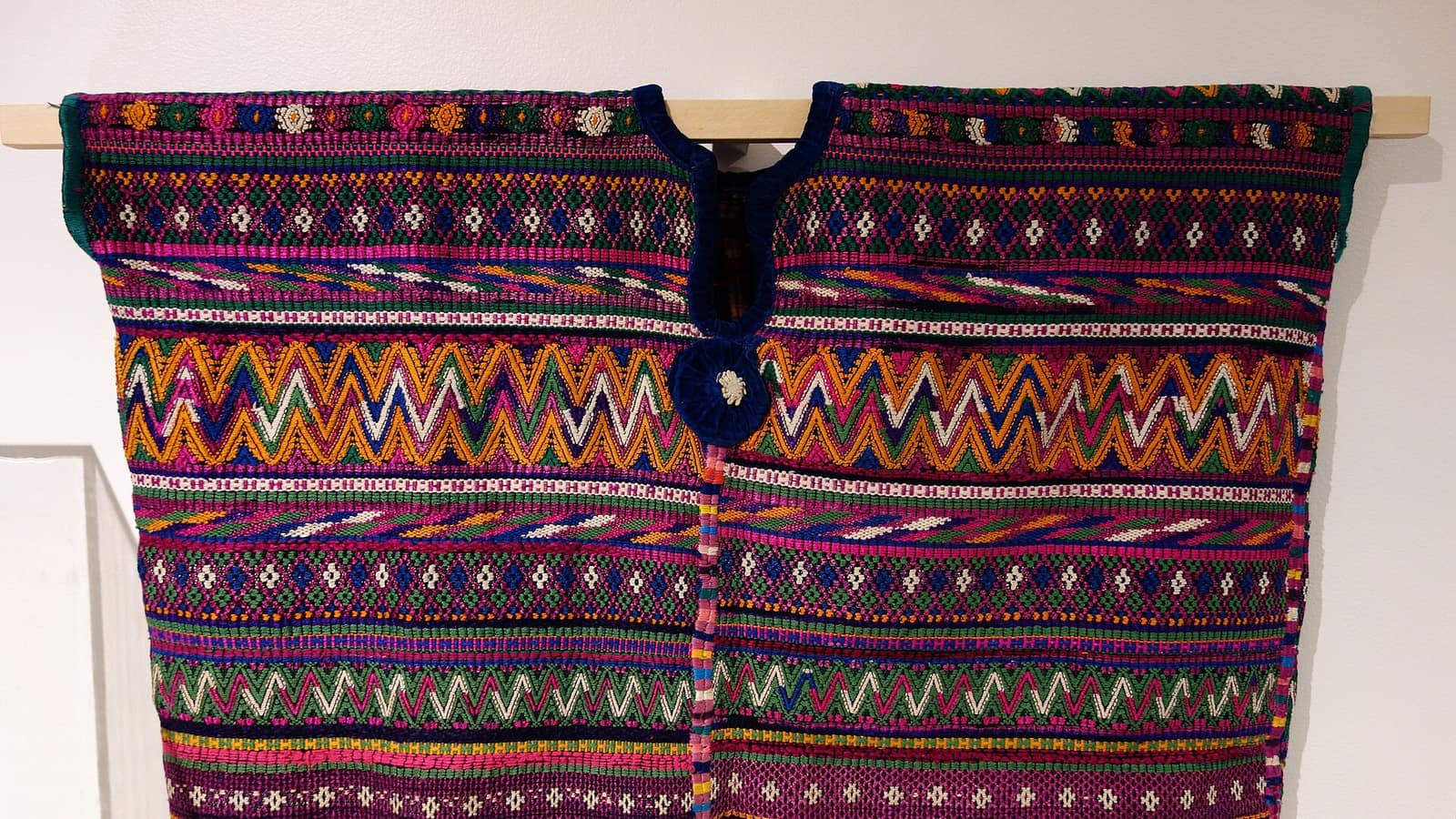
Traditional dress is still worn daily in the Guatemalan highlands, and it is village-specific: the huipil of Nebaj is not the huipil of Todos Santos. Twenty-two Mayan languages, dozens of towns, and a cloth that says which one before anyone speaks.
The highest of the tepuis, standing on the Venezuela-Brazil-Guyana border, and the mountain behind Conan Doyle's Lost World. Non-technical but sustained: a walk-up with no climbing and no easy days.
Colonial capital from 1543 until the 1773 earthquakes moved the government away, and the abandonment is exactly why the townscape survives: ruined convents left standing where a working capital would have cleared them.
A flooded caldera ringed by three volcanoes, with a dozen towns around the shore that differ in dress, dialect and trade. The launches, not the roads, are the real network.
A 300-metre limestone bridge carrying a staircase of pools, with the Cahabón running underneath it through the rock. The K'anba caves are the same karst and the same day.
979 metres off the flank of Auyán-tepui, most of it turning to mist on the way down. The approach is by river, and the river only carries boats in the wet season, so the season is the first decision.
Twice a week the K'iche' town fills its plaza and the steps of Santo Tomás, and most of what changes hands is still for the towns around it rather than for visitors.
7 bays · hover or tab to open one7 bays · select one to openGuatemala · Venezuela · Peru · Bolivia
A Latin America Travel Guide to Adventure and Cultural Destinations
Latin America travel splits, in practice, into two kinds of trip: the ones you
take for the landscape and the ones you take for the people who live in it. This guide is
organised around that split: Guatemala's highlands, Venezuela's
tepuis and the Peruvian sierra, with each destination covered as one subject rather than as
an entry in a list.
Every page here answers the same four questions: what the place is, where it sits, what
reaching it actually involves, and which part of the year makes that possible. Access
conditions change (park fees, guide requirements, road surfaces, seasons), so each page
carries the date its figures were last checked.
Destinations, and how they are grouped here
Central America travel is the cheaper and more improvisable half of this region: in Guatemala
the destinations sit two or three hours apart on a shuttle, and a fortnight covers most of
them. South America travel is planned the other way round, which is why the two halves are
kept apart here — the logistics barely overlap. In Venezuela a single waterfall is a
three-day river trip. Any Guatemalan plan can be improvised on arrival, and no Venezuelan
one can.
Guatemala travel carries the deepest coverage on this site, because that is where the
material is: Antigua and Lake Atitlán, the market at Chichicastenango, two walk-up volcanoes,
the karst pools at Semuc Champey and the highland dress that is the reason to go slowly
through all of them. The other destinations are deliberately thinner — Roraima and Angel
Falls for the tepui country, Inka stonework and the Inca Trail for the Peruvian sierra.
Adventure and cultural travel, and why the distinction matters
Adventure here means what it says: a walk-up mountain with no road to it, a cave entered with
a candle, a river that is only navigable half the year. Cultural travel means market days,
weaving towns and religious observance that is still observance rather than performance. Most
of the destinations below are both, and the ones that are only one are marked as such.
The distinction matters because it changes the season, the cost and the company. An
adventure itinerary is scheduled around water levels and cloud; a cultural one is scheduled
around market days and fiestas, which move for nobody.
Using this Latin America travel guide
Latin America travel packages sold abroad tend to compress the region into a fortnight of
airports. They are a reasonable way to see Machu Picchu and a poor way to see anything that
needs a spare day for weather, which is why most Latin America travel packages skip the
tepuis entirely.
This guide assumes the opposite: that you are assembling the trip yourself and want to know
which parts genuinely need a guide, which need a season, and which need only a bus ticket and
an early start.
Frequently Asked Questions
How long do you need for a first trip to Latin America?
It depends which half. Guatemala's highland circuit works in a fortnight because the destinations sit two or three hours apart. Venezuela's tepui country does not: Roraima is six days on foot and Angel Falls three days on water, and they want opposite halves of the year.
Which season should you travel in?
For the Central American highlands, November to April is dry and reliable. For Angel Falls the wet season, June to November, is the only one that floats the boats. For the Roraima trek the drier months, December to April, give the better odds of a view and the easier river crossings.
How much of this can be arranged on arrival?
Guatemala travel is nearly all improvisable: shuttles, guides and rooms are bookable a day ahead outside Semana Santa. In Peru the Inca Trail permits and Machu Picchu entry tickets sell out months ahead. In Venezuela the trips are run by a small number of operators and are arranged in Santa Elena or Canaima rather than online.
Where is a guide actually required rather than recommended?
On Mount Roraima and at Angel Falls, where park rules require an authorised Pemón guide; on the Inca Trail, which has been guided-only since 2001; and at the volcano park gates in Guatemala. Everywhere else on this site a guide is optional and usually worth it inside ruins.
Is this part of the world safe to travel in?
The tourist circuits in Guatemala and Peru are well established and the usual urban precautions cover most of it. Venezuela is the exception, not for the mountains but for the logistics around them, and it is the one place on this site where current advice matters more than anything written here.
What does the check date on each page mean?
It is when the changeable figures on that page (fees, permits, seasons, road conditions) were last verified. Altitudes and history do not carry a date because they do not move.


_-_10.jpg)