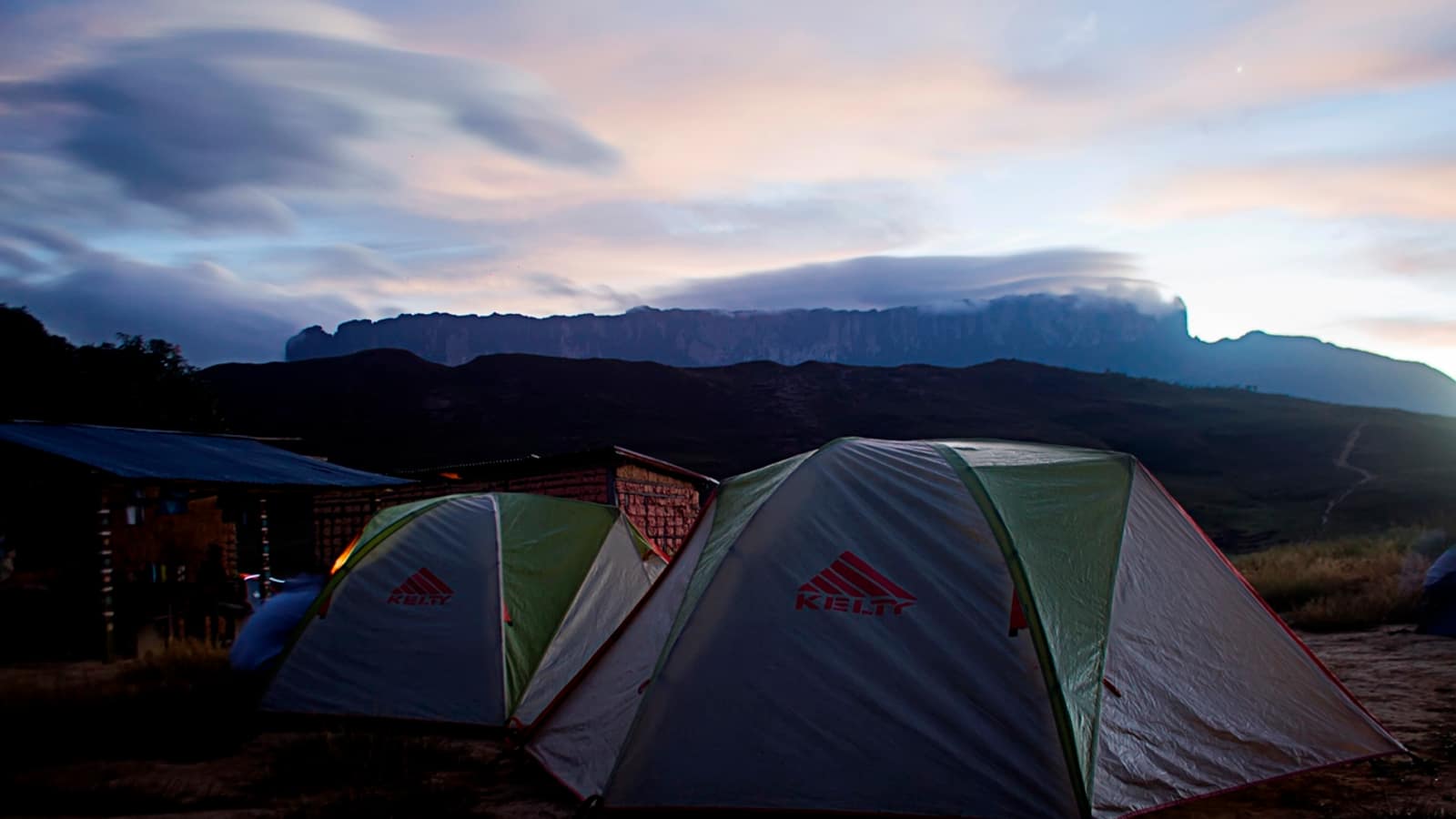

Gran Sabana, Venezuela
Mount Roraima, Venezuela: Trekking the Tepui Behind The Lost World
The highest of the tepuis, standing on the Venezuela-Brazil-Guyana border, and the mountain behind Conan Doyle's Lost World. Non-technical but sustained: a walk-up with no climbing and no easy days.
- Summit
- 2,810 m
- Trek
- 6 days
- Trailhead
- Paraitepui
Mount Roraima — Venezuela’s highest tepui — is one of the flat-topped sandstone mountains that stand out of the savanna in the country’s south-east. Its plateau sits at about 2,810 m, at the point where Venezuela, Brazil and Guyana meet, and it is the one tepui most people can name, because Arthur Conan Doyle put a plateau of surviving dinosaurs on top of one in 1912 and called the book The Lost World.
The mountain earned the attention for a better reason than the novel. It is one of the few tepuis with a natural ramp up its wall, which means Roraima can be walked. Everything else about it, the isolation, the endemic species and the sheer 400-metre cliffs, applies to its neighbours too. Roraima is simply the one you can reach on foot.
What a tepui is, and why Roraima is the famous one
The tepuis are the remains of a sandstone plateau laid down before South America and Africa separated, eroded over a very long time into isolated blocks with vertical walls and level tops. Each summit has been cut off from the savanna below for millions of years, which is why the plants up there are found nowhere else, and why the surface itself is bare rock, scoured by rain, holding almost no soil.
Roraima tepui is the highest of them, and the Roraima tepui massif shares a base with Kukenán, its neighbour to the north, whose wall is the one people photograph from the approach. The word tepui is Pemón, the language of the people whose land the mountain stands on and who guide almost every group that climbs it.
The Mount Roraima trek: Paraitepui to the summit
The Mount Roraima trek starts at Paraitepui de Roraima and takes six days in its standard form. Day one and two cross open savanna to the base camp below the wall, with two river crossings, the Tök and the Kukenán, that are trivial in the dry season and occasionally impassable in the wet. Day three climbs the ramp: a long, steep, often wet ascent through cloud forest and under a waterfall that soaks everyone regardless of what they are wearing.
Then one or two days on the plateau, and two back down the same way. Nothing on the route requires climbing, which is what people mean when they call it non-technical, and nothing about it is easy either. The days are long, the packs are heavy unless porters carry them, and the descent is where most injuries happen.
Hiring Pemón porters is the normal arrangement and the one worth making. It converts the two approach days from an endurance problem into a walk, and the wage stays in Paraitepui rather than in Santa Elena.
Getting to Roraima in Venezuela: Santa Elena, permits and guides
Every trip to Mount Roraima — Venezuela’s approach is the only walkable one — starts in Santa Elena de Uairén, the border town on the Brazilian side of the Gran Sabana. Trips are arranged there, food is bought there, and the road out to Paraitepui, rough and worse after rain, leaves from there.
A guide is not optional. Mount Roraima sits inside Canaima National Park, and park rules require an authorised guide from the local communities to accompany every group. This is enforced at the trailhead rather than negotiated, and it is also the reason the route is as clean as it is: guides run the camps, and the camps have rules.
Practical conditions across this part of Venezuela have changed repeatedly over the past decade. fuel, cash, transport and border formalities more than the mountain itself. That is the part of the trip to check against current sources rather than any static page.
On top: the Lost World that Conan Doyle never saw
The summit is not a meadow. It is black sandstone, weathered into towers, basins and channels, with pockets of white quartz crystals, shallow pools, and vegetation clinging wherever a little peat has gathered. Cloud sits on it most of the time. When it lifts, the drop to the savanna is sudden and total.
Camps on the plateau are overhangs, hoteles in the local usage, chosen because they keep the rain off. Groups walk from them to the usual points: the triple border marker, the crystal valleys, the viewpoint known as La Ventana when the cloud allows it.
Conan Doyle never came here. He read accounts by the botanists and surveyors who did, and the detail that caught him is the true one: a summit isolated long enough to go its own way.
Mount Roraima animals, plants and the water
Mount Roraima animals are, with few exceptions, small. The best known is the Roraima black frog, Oreophrynella quelchii, which cannot hop well and escapes by curling into a ball and rolling. Little else large enough to notice lives permanently on the plateau; the birds visit, and the insects stay.
The plants are the real inhabitants. Marsh pitcher plants of the genus Heliamphora trap insects because the bare rock gives them nothing, and several are endemic to single summits. So are many of the bromeliads and sundews. This is the practical argument for staying on the routes between camps: what grows here grows slowly and does not come back within a human lifetime.
Water on top is everywhere and stains dark red-brown with tannins, which is normal and not a sign of contamination, though guides still decide where a group draws it.
Roraima and the rest of the Gran Sabana
Most people who walk Roraima also see Angel Falls, further north in the same national park and reached by river rather than on foot; the two together are the standard Venezuelan itinerary, and both depend on the season more than on anything you plan. The wider Venezuela section covers the Gran Sabana beyond the tepuis.
Frequently Asked Questions
How high is Mount Roraima?
The summit plateau stands at about 2,810 m. The high point sits at the southern edge of the plateau. The Brazil–Venezuela–Guyana border marker is lower, at about 2,734 m, and Guyana's own high point is a separate northern spur at 2,772 m, though the usual walking route reaches the plateau on the Venezuelan side and never goes near it.
Do you need climbing experience for the Mount Roraima trek?
No. The Mount Roraima trek follows a natural ramp on the south-west face and is a walk throughout, with no ropes and no exposure that requires technique. It is sustained rather than technical: consecutive long days with a heavy pack unless you hire porters.
How long does the trek take?
Six days is standard: two to the base and up to the plateau, one or two on top, two down. Adding a day on the summit is the single best change most people can make to the itinerary, because one day up there is mostly weather.
Is a guide compulsory?
Yes. The mountain lies inside Canaima National Park, and park rules require walkers to be accompanied by an authorised guide from the Pemón communities. Porters are hired separately and are worth the money on the two long approach days.
Where does the trek start?
The trek starts at Paraitepui de Roraima, a Pemón village reached by rough road from Santa Elena de Uairén, near the Brazilian border. Most trekkers arrive in Santa Elena first, arrange the trip there, and drive out to the village the same day or the next morning.
What is the weather like on top?
Wet, cold and fast-changing. The plateau makes its own cloud, and rain is possible on any day of the year; nights can drop close to freezing. Rain gear that actually works and a sleeping bag rated colder than you expect are the two pieces of kit people most often get wrong.
When is the best time to go?
The drier months, roughly December to April, give better odds of a view and easier river crossings. The rivers on the approach, the Tök and the Kukenán, can rise enough in the wet season to hold a group up for a day.
What animals live on Mount Roraima?
Very few large ones. The Mount Roraima animals worth looking for are all small. The plateau's fame rests on small endemics: the Roraima black frog, which rolls into a ball and lets itself bounce down rock rather than hopping away, and carnivorous marsh pitcher plants of the genus Heliamphora that live on rainwater because the bare sandstone offers almost no nutrients.
Are there dinosaurs on top, as in the novel?
No, and there never was a scientific claim that there were. Conan Doyle borrowed the isolation of the tepuis for The Lost World in 1912. What survived the isolation is small, strange and botanical rather than large and toothed.
Can you visit Roraima from Brazil or Guyana instead?
The standard walking route is the Venezuelan one from Paraitepui. Approaches on the Brazilian and Guyanese sides exist but are expeditions rather than treks, without an established path up the wall.
Is it safe to travel in this part of Venezuela?
Conditions in Venezuela have changed repeatedly over the last decade and are the part of this trip that most needs current information rather than a page like this one. Check your government's current travel advice and talk to operators actually running trips this season before committing.
What should you not do on the summit?
Leave anything, including human waste. Groups carry out what they carry in, and the standard is enforced by guides. The plateau's soils are thin and its endemic plants slow-growing, so walking off the marked routes between camps does damage that lasts.