Venezuela's Gran Sabana: the Tepuis, Roraima and Angel Falls
The Gran Sabana and the tepui country: flat-topped sandstone massifs standing out of the savanna, one of which can be walked and one of which produces the highest waterfall on earth.
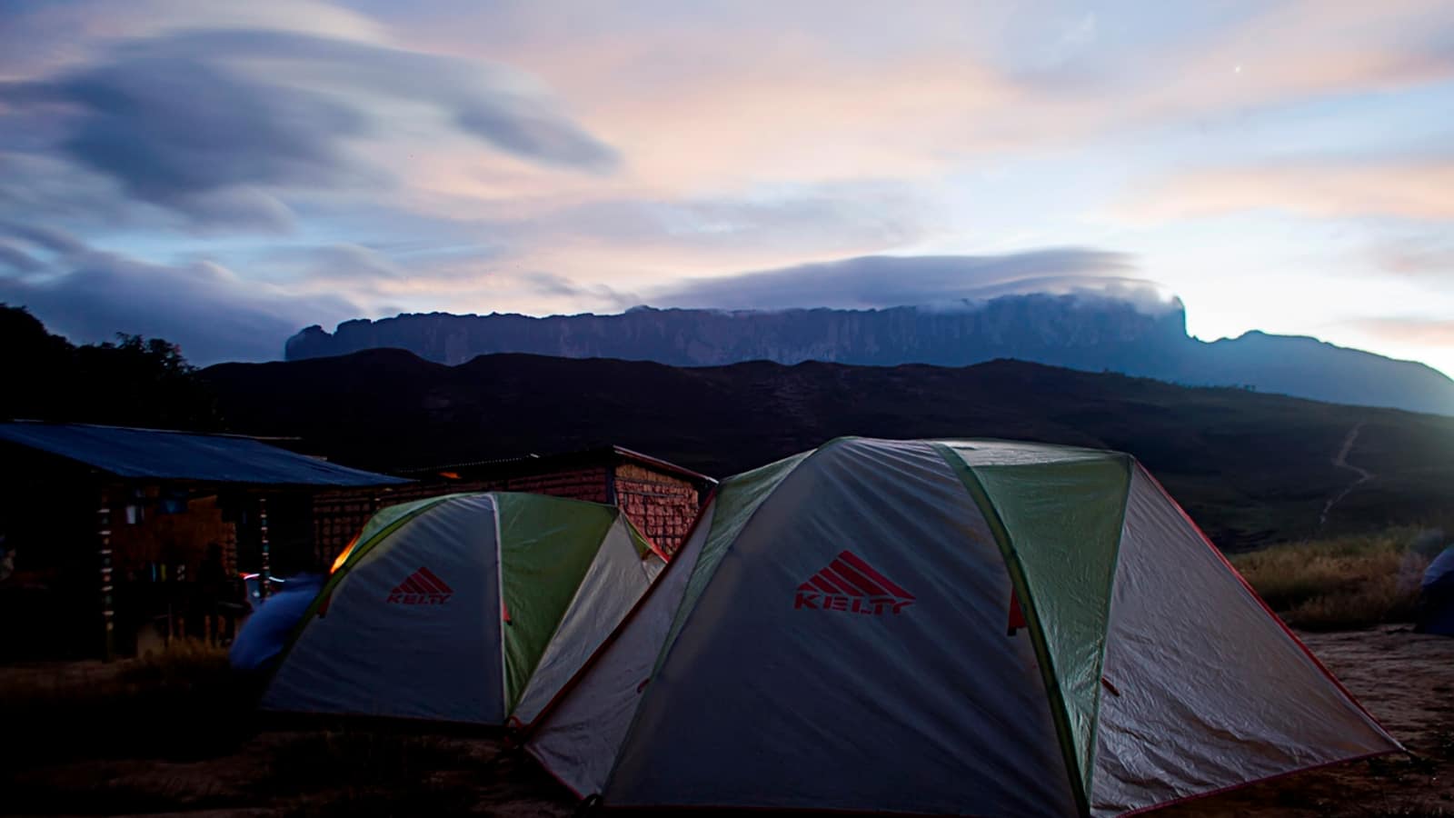

This section covers one region rather than a country. The Gran Sabana, in Bolívar state, is where the tepuis are: remnants of an ancient sandstone plateau, isolated for long enough that what grows on top of them grows nowhere else.
Two trips define it. Roraima is six days on foot from Paraitepui, best in the drier months. Angel Falls is three days by river from Canaima, and only possible in the wetter ones. They pull in opposite directions on the calendar, which is the first thing to know before trying to fit both into one trip.
- Angel Falls Canaima, Venezuela
979 metres off the flank of Auyán-tepui, most of it turning to mist on the way down. The approach is by river, and the river only carries boats in the wet season, so the season is the first decision.
- Mount Roraima Gran Sabana, Venezuela
The highest of the tepuis, standing on the Venezuela-Brazil-Guyana border, and the mountain behind Conan Doyle's Lost World. Non-technical but sustained: a walk-up with no climbing and no easy days.
Two seasons, two trips
Between roughly December and April the rivers drop. That is the window for the Roraima trek, when crossings are easy and the plateau is more often clear. It is the wrong half of the year for the falls, when boats frequently cannot get up the Churún and the water thins.
Between June and November the position reverses. The rivers carry the curiaras to Angel Falls at full flow, and the same rain makes the Roraima approach wetter, the ramp slippery and the summit view a matter of luck.
Getting around
Neither destination has a road. Canaima is reached by light aircraft; Paraitepui by rough track from Santa Elena de Uairén, near the Brazilian border. Both trips are run by Pemón communities, and in both cases a guide is required rather than recommended.
Current conditions
Practical conditions in this part of Venezuela (flights, fuel, cash, permits, border formalities) have changed repeatedly over the last decade and change faster than a reference page can follow. The geography on these pages is durable; the logistics are not. Check government travel advice and speak to operators actually running trips this season.
What the Gran Sabana is
A rolling savanna at around 1,000 m, cut by rivers with tea-coloured water and studded with tepuis, running south from the Orinoco basin to the Brazilian border. The single road through it, Ruta 10 from Ciudad Guayana to Santa Elena, is the spine of any overland trip here, and the waterfalls along it are the reason the drive is not simply a transfer.
What else is on Ruta 10
The road south is not simply the way to the trailhead. It climbs out of the Orinoco lowlands onto the savanna at La Escalera and then runs for hours between tepui walls, and the rivers crossing it drop over the same sandstone in a series of falls that are pull-in-and-swim accessible: Kama Merú, Kawí and Aponwao among them, all signposted, all with a small local charge. Quebrada de Jaspe, near the southern end, runs over a bed of red jasper that turns the whole streambed the colour of rust when the water is low.
None of these is a destination on its own. Together they are the reason an overland trip through the Gran Sabana is worth two or three days rather than one long drive, and the reason most operators build the transfer as a route rather than a transfer.
What the season actually costs you
Picking the wrong half of the year does not spoil either trip so much as change what it is. A Roraima trek in the wet months is still a trek: the ramp is slippery, the rivers can hold a group up for a day, and the plateau is in cloud more often than not, so the walking is the reward and the view is a bonus. Angel Falls in the dry months is still a visit to Canaima: the lagoon and its own falls are there, the flights operate, and the overflight shows the drop from the air, but the curiaras frequently cannot get up the Churún at all.
Anyone with one trip and a strong preference should choose by which of the two they would rather do properly, because doing both properly means two visits in opposite halves of the year.
The Pemón, and why guides are not optional
Both trips in this section run on Pemón land inside a national park, and both are staffed by Pemón guides, porters and boat crews. The guide requirement is a park rule, and it is also the mechanism by which the money from visitors reaches the communities the land belongs to.
Frequently Asked Questions
Can you visit Roraima and Angel Falls on the same trip?
Physically yes, practically they pull in opposite directions: Roraima wants the drier months and Angel Falls needs the wet ones. Doing both well means either accepting compromise on one or two separate trips.
How do you reach the Gran Sabana?
By road from Ciudad Guayana down Ruta 10 to Santa Elena de Uairén, or by air to Canaima for the falls. There is no road to Canaima.
Do you need a guide?
Yes for both trips, and it is a park rule rather than a recommendation. Guides, porters and boat crews are from the Pemón communities whose land the park covers.
What is a tepui?
A flat-topped sandstone massif, the eroded remnant of an ancient plateau, isolated long enough that much of what grows on top is found nowhere else. Roraima is the highest and the only one with a walking route.
What is the weather like?
Warm in the savanna, cold and wet on the Roraima plateau, and humid on the rivers. Rain is possible in any month; the difference between seasons is how much.
Is it currently practical to travel here?
The geography does not change; the logistics do. Flights, fuel, cash and permits in this part of Venezuela have shifted repeatedly over the last decade, so check current government travel advice and speak to operators running trips this season.