Peru's Sierra: Inka Stonework, the Inca Trail and Machu Picchu
Stonework, water and the sierra. The subjects here are the ones where Inka engineering is still legible on the ground rather than reconstructed on a plaque.
_(4577531523).jpg)
Peru is the part of this site least concerned with getting to a viewpoint and most concerned with how something was built. The Inka worked stone without iron tools, moved water across terraces by gravity alone, and spanned gorges with grass rope. All three can still be seen doing their job rather than sitting in a museum.
The sierra above Cusco is where most of it sits, between roughly 2,400 m and 4,200 m, which makes altitude the first practical constraint on any itinerary here.
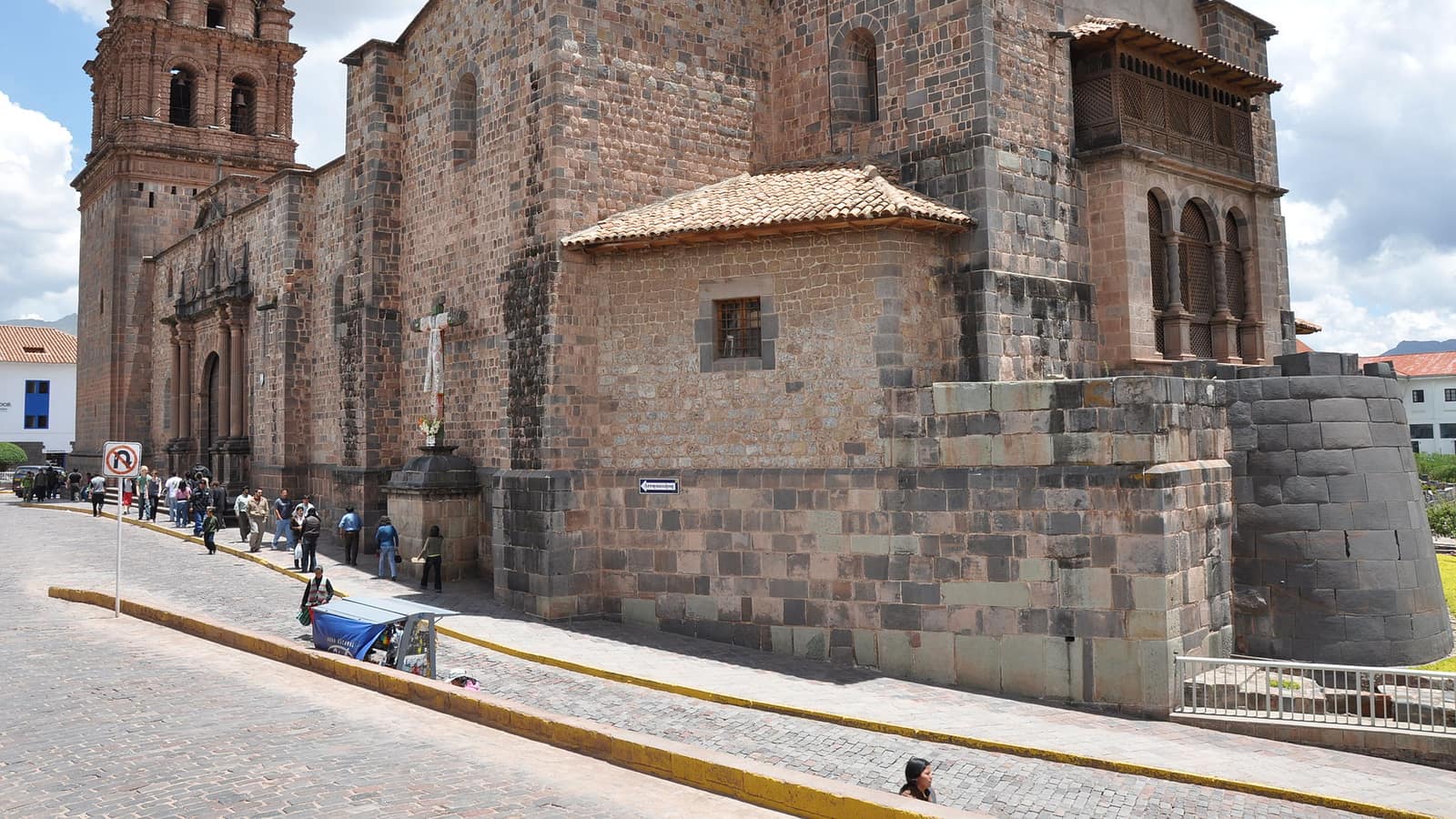
- Inca architecture Cusco and the Sacred Valley, Peru
Walls built without mortar, without iron tools and without wheels, fitted closely enough that they have outlasted every colonial building put on top of them.
- The Inca Trail Cusco region, Peru
Four days on a paved Inka road over two passes, ending at the Sun Gate. Permit-capped, sold out months ahead, and closed every February.
- Q'eswachaka rope bridge Canas, Cusco region, Peru
The last surviving Inka suspension bridge, cut down and rebuilt from twisted grass every June by the four communities that have always maintained it.
- The fountains of Machu Picchu Machu Picchu, Cusco region, Peru
Sixteen stone basins fed by a single spring through a canal cut across the mountainside, dropping through the site in order of precedence, and still running.
Altitude comes first
Cusco sits at about 3,400 m and most arrivals fly straight into it. Two nights before doing anything strenuous is the standard advice and the reason the Sacred Valley, several hundred metres lower, is a better first stop than the city itself.
The Inca Trail, and the alternatives to it
The classic four-day route to Machu Picchu is permit-controlled, capped daily, and sells out months in advance; it also closes each February for maintenance. The Salkantay, Lares and Choquequirao routes are the usual answers when permits are gone, and none of them arrive at the Sun Gate.
Water, and what it was for
The fountains at Machu Picchu are a sequence of sixteen, fed by a spring on the mountainside and dropping through the site in order of precedence. They are the clearest surviving example of Inka hydraulic planning, and they are still running.
The last woven bridge
Q'eswachaka, over the Apurímac, is rebuilt every year from grass rope by the four communities that have always maintained it. The rebuild takes three days and is the only surviving example of a technology that once held an empire's road network together.
Terraces, and what they were for
The agricultural terraces across the sierra are usually read as farmland, and they are also drainage and retaining structures. At Moray, near Maras, a set of concentric circular terraces holds a measurable temperature gradient from top to bottom. The standard interpretation is that it was used to test crops at different altitudes without moving them.
The Sacred Valley, in the order that works
The valley is usually done as a day trip from Cusco and works better as a base. Pisac has the terraces and a market; Ollantaytambo has the best-preserved Inka town plan anywhere, with streets and water channels still on their original lines, and it is where the trains leave from; Chinchero, Moray and the Maras salt pans sit on the higher road back. Two nights in Ollantaytambo or Urubamba, several hundred metres below Cusco, does more for acclimatisation than any amount of coca tea.
Tickets, and the thing that catches people out
Machu Picchu entry is sold by circuit and by time slot, capped daily, and the circuits do not all reach the same parts of the site. A ticket that does not include the route you assumed is the single most common planning error here, and it cannot be fixed at the gate. The Boleto Turístico, a separate combined ticket, covers most of the Sacred Valley sites and Cusco's museums, and does not cover Machu Picchu at all.
Huayna Picchu and Machu Picchu mountain are separate add-ons with their own small quotas and their own entry windows. Both sell out well before the main tickets do.
Getting around the sierra
Cusco is the hub for everything in this section and the Sacred Valley is the better place to sleep on arrival, several hundred metres lower. Trains to Aguas Calientes run from Ollantaytambo and Poroy; there is no road to Machu Picchu, and the alternative to the train is a long approach via Hidroeléctrica that costs a day.
Frequently Asked Questions
How long do you need in the sierra?
Ten days covers Cusco, the Sacred Valley, Machu Picchu and one trek at a sensible pace. Less than a week means either skipping the trek or arriving with no acclimatisation buffer.
How do you deal with the altitude?
Sleep low before going high: the Sacred Valley sits several hundred metres below Cusco and is a better first night. Two nights before anything strenuous, and coca tea is a tradition rather than a treatment.
Do you need a permit for Machu Picchu itself?
Yes: timed entry tickets by circuit, sold in advance and capped daily. The Inca Trail permit is separate and books out months earlier.
What is the best month?
May to September is dry and busy; the shoulder months of April and October trade a little rain for far fewer people. February is the wettest and the month the Inca Trail closes.
Is the train the only way to Machu Picchu?
Effectively. Trains run from Ollantaytambo and Poroy to Aguas Calientes; the alternative is the long overland route via Hidroeléctrica, which costs a day at each end.
What is worth seeing besides Machu Picchu?
Ollantaytambo for unfinished stonework, Moray for the terrace experiment, and the Q'eswachaka bridge if the timing lines up with the June rebuild.