
Sololá, Guatemala
Lake Atitlán, Guatemala: the Villages from Panajachel to San Pedro
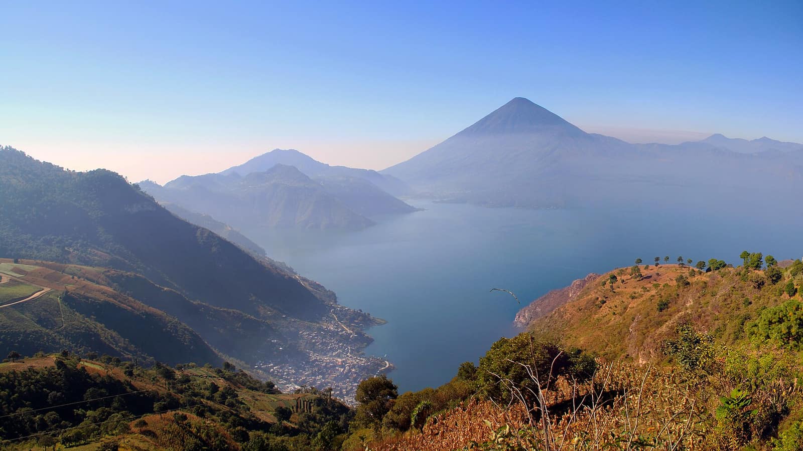
A flooded caldera ringed by three volcanoes, with a dozen towns around the shore that differ in dress, dialect and trade. The launches, not the roads, are the real network.
- Elevation
- 1,562 m
- Depth
- ≈340 m
- Villages
- 12+
Lake Atitlán — Guatemala’s deepest lake, and the one every visitor photographs — fills a caldera at about 1,562 m, ringed by three volcanoes and a dozen towns that differ from each other in dress, dialect and trade. Things to do in Lake Atitlán are mostly a question of which of those towns you spend your time in, because the lake is not a resort with satellites: it is a set of distinct places that happen to share water.
The water is roughly 340 m deep, which makes it the deepest in Central America, and it has no river running out of it. What goes in leaves underground, and the level moves accordingly, a fact you can see in the drowned ground floors along several shorelines.
The villages, and what each one is actually for
The lakeside villages are the subject. In rough order around the shore:
- Panajachel. The transport hub and the main market for anyone living around the lake. Busiest, least atmospheric, most useful.
- Santa Catarina Palopó. Small, close to Panajachel, and identifiable at a glance from the blue-and-turquoise dress adopted across the town.
- San Antonio Palopó. Terraced hillside, onions and pottery, quieter again.
- Santiago Atitlán. The largest of the lake towns, Tz’utujil-speaking, with a working market and Maximón in residence rather than on display.
- San Pedro La Laguna. Cheap rooms, language schools, the volcano trailhead, and most of the lake’s nightlife.
- San Juan La Laguna. Next door to San Pedro and its opposite: weaving and natural-dye cooperatives, painters’ galleries, early nights.
- San Marcos La Laguna. The meditation-and-retreat end of the lake, plus a cliff people jump off.
- Santa Cruz, Jaibalito and Tzununá. North shore, reachable only by boat or footpath, which is the entire point of staying there.
Panajachel and San Pedro: the two poles
Most itineraries end up anchored on Panajachel or San Pedro, and they are not interchangeable.
Panajachel is where the road arrives, where the shuttles leave from, where the banks and the pharmacies are, and where you can buy a hammock at eleven at night. Calle Santander runs from the main street down to the dock and is one continuous market. Nobody comes to Guatemala for it, and almost everybody passes through it.
San Pedro sits under its volcano across the water, and its economy is language students and long-stay travellers. Rooms cost a fraction of Panajachel’s, restaurants are open late, and the dock area is dense in a way the rest of the lake is not. The volcano above it, San Pedro at about 3,020 m, is the standard climb: steep, half a day, guided from the gate.
If neither appeals, San Juan is the answer more people should give: the same crossing, ten minutes further, and a town that lives off weaving rather than off arrivals.
Getting to Lake Atitlán in Guatemala
The Antigua to Lake Atitlán shuttle is the normal approach, two and a half to three and a half hours to Panajachel, depending on how many hotels the driver collects from. Coming straight off a flight, the Guatemala City to Lake Atitlán run takes three to four hours and is worth breaking in Antigua unless you enjoy long first days.
Both the Antigua to Lake Atitlán and the Guatemala City to Lake Atitlán services drop at the Panajachel dock rather than at individual hotels, which is worth knowing if you are staying across the water.
From Chichicastenango on a Thursday or Sunday, the lake is an hour and a half away, which is why the market and the lake sit next to each other in most itineraries. The rest of the region is in the Guatemala section.
Once you are here, the boats replace the road. Public lanchas leave Panajachel when they are full, run the western circuit and the Santiago route as separate services, and stop in the late afternoon. The Xocomil, the wind that comes up around midday, is the reason: it makes the open crossings rough enough that the crossing you postponed to five o’clock may not exist.
Things to do in Lake Atitlán beyond the boat
- Climb San Pedro. Three to five hours up, guided, and the view is the standard reward.
- Walk the north shore. Santa Cruz to Jaibalito to Tzununá on the footpath, no road involved.
- Sit in on a weaving demonstration in San Juan, where the cooperatives dye with plants and will show you the process before they show you the shop.
- Visit Maximón in Santiago, in whichever house holds him this year.
- Kayak the early morning, before the wind, from Santa Cruz or San Marcos.
- Cross to a market: Sololá on Friday, above the lake, is a working highland market with very little tourist trade in it.
That list is the short answer to things to do in Lake Atitlán; the longer one is that the towns themselves are the attraction, and the boat between them is how you see it.
Three days is the honest minimum for Lake Atitlán — Guatemala’s densest cluster of distinct towns in one place. One day gives you a boat ride and a lunch, which is a nice afternoon and not a visit.
Frequently Asked Questions
How do you get from Antigua to Lake Atitlán?
Tourist shuttles run daily and take two and a half to three and a half hours to Panajachel depending on the road and the number of hotel pickups. Chicken buses are cheaper and involve a change at Chimaltenango and another at Sololá.
How long does Guatemala City to Lake Atitlán take?
Three to four hours by shuttle to Panajachel, longer if you leave the capital during the morning peak. Most visitors break the trip in Antigua rather than doing it in one run from the airport.
Which village should you stay in?
Panajachel if you want transport links and shops, San Pedro for cheap rooms and nightlife, San Marcos for the quiet-and-yoga end of the market, San Juan for weaving cooperatives and far fewer bars, Santa Cruz or Jaibalito if you want to be somewhere the road does not reach. Santiago Atitlán is the biggest and least tourist-shaped of them.
How do the boats work?
Public lanchas run between the villages from early morning until late afternoon, leaving when they fill rather than to a timetable. Panajachel is the hub; the western circuit (San Marcos, San Juan, San Pedro) and the Santiago route are effectively two different services.
When do the boats stop running?
Late afternoon, and earlier than you expect on the exposed crossings, because the Xocomil wind gets up around midday and can make the open water rough. Plan to be back before dark rather than assuming a late boat.
Is Lake Atitlán safe to swim in?
People swim daily, mostly off the deeper northern shore. Water quality varies with the season and with proximity to town outflows, and the lake has had cyanobacteria blooms, the worst of them in 2009. Swim away from settlements and ask locally before going in after heavy rain.
Can you climb the volcanoes?
San Pedro is the standard climb, a steep half-day from the village of the same name with a guide required at the park gate. Tolimán and Atitlán are longer, less trafficked and usually done as overnight trips with a local guide.
What is Maximón?
A folk saint venerated in several highland towns, most visibly in Santiago Atitlán, where a cigar-smoking effigy is housed each year in a different cofradía member's house. Visits are normal and expected; a small donation and asking before photographing are the etiquette.
How deep is the lake?
Around 340 m at its deepest, which makes it the deepest lake in Central America. It fills a caldera left by an eruption between about 79,500 and 84,000 years ago, depending on the dating method that laid ash as far as Florida and Ecuador.
Why is the water level rising?
The lake has no surface outlet and drains underground, so its level moves with rainfall and with whatever is happening below. Levels rose sharply from 2009 onwards and drowned lakeside buildings in several villages, some of which are still standing in the water.
Do you need more than a day?
A day gets you one village and a boat ride. Three days is the point where the differences between the towns start being the reason you came, rather than a detail you read about afterwards.
Is it worth visiting in the rainy season?
Yes, with a caveat: mornings are usually clear and the afternoons close in. Book crossings for the morning, expect the volcanoes to disappear after lunch, and take the greener hillsides as compensation.